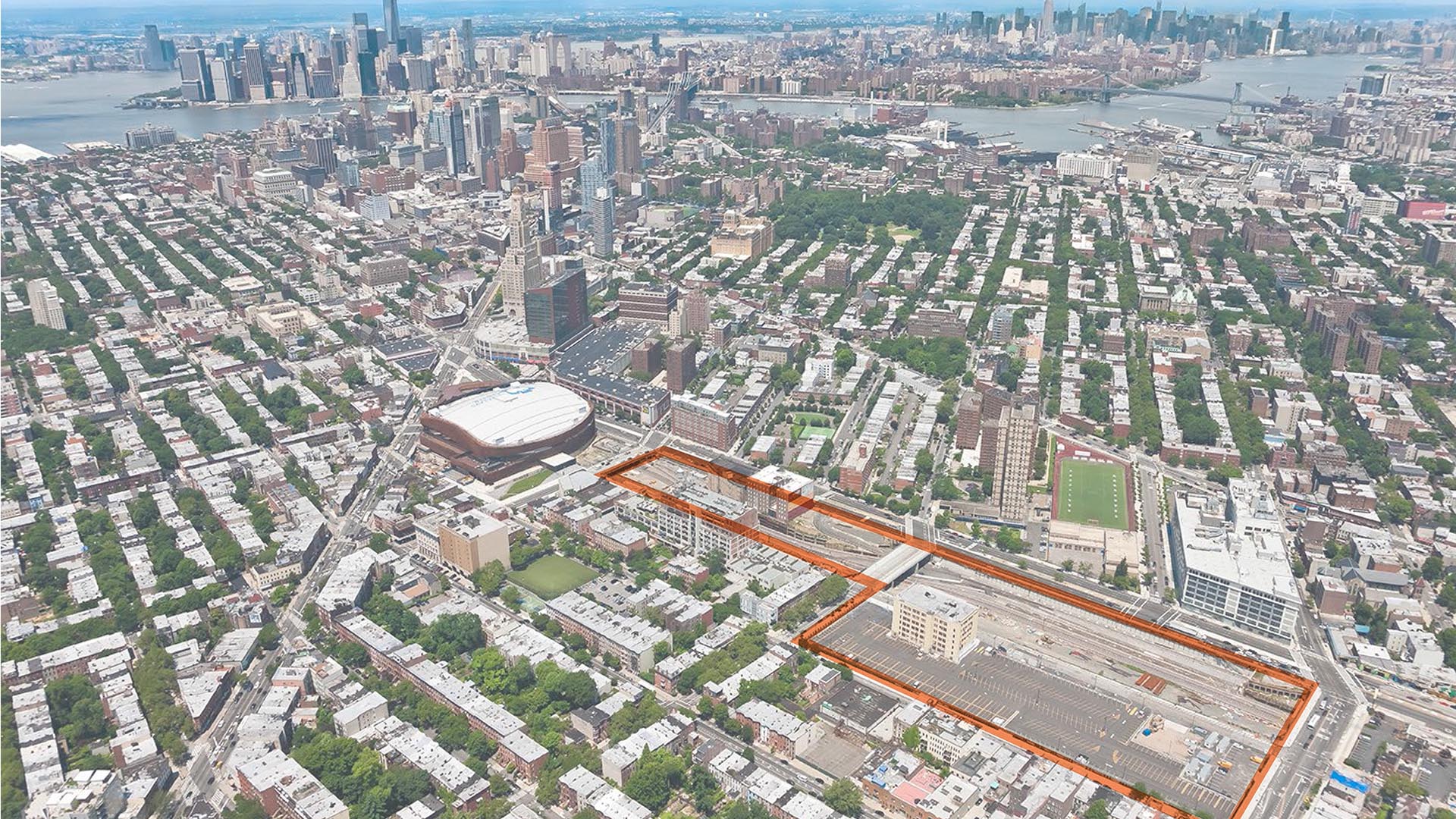
Pacific Park is a major mixed-use development in the Atlantic Terminal area of Brooklyn, New York. When complete, it will occupy approximately 22 acres, including the air rights above the approximately nine-acre, below-grade Long Island Rail Road Storage Yard.
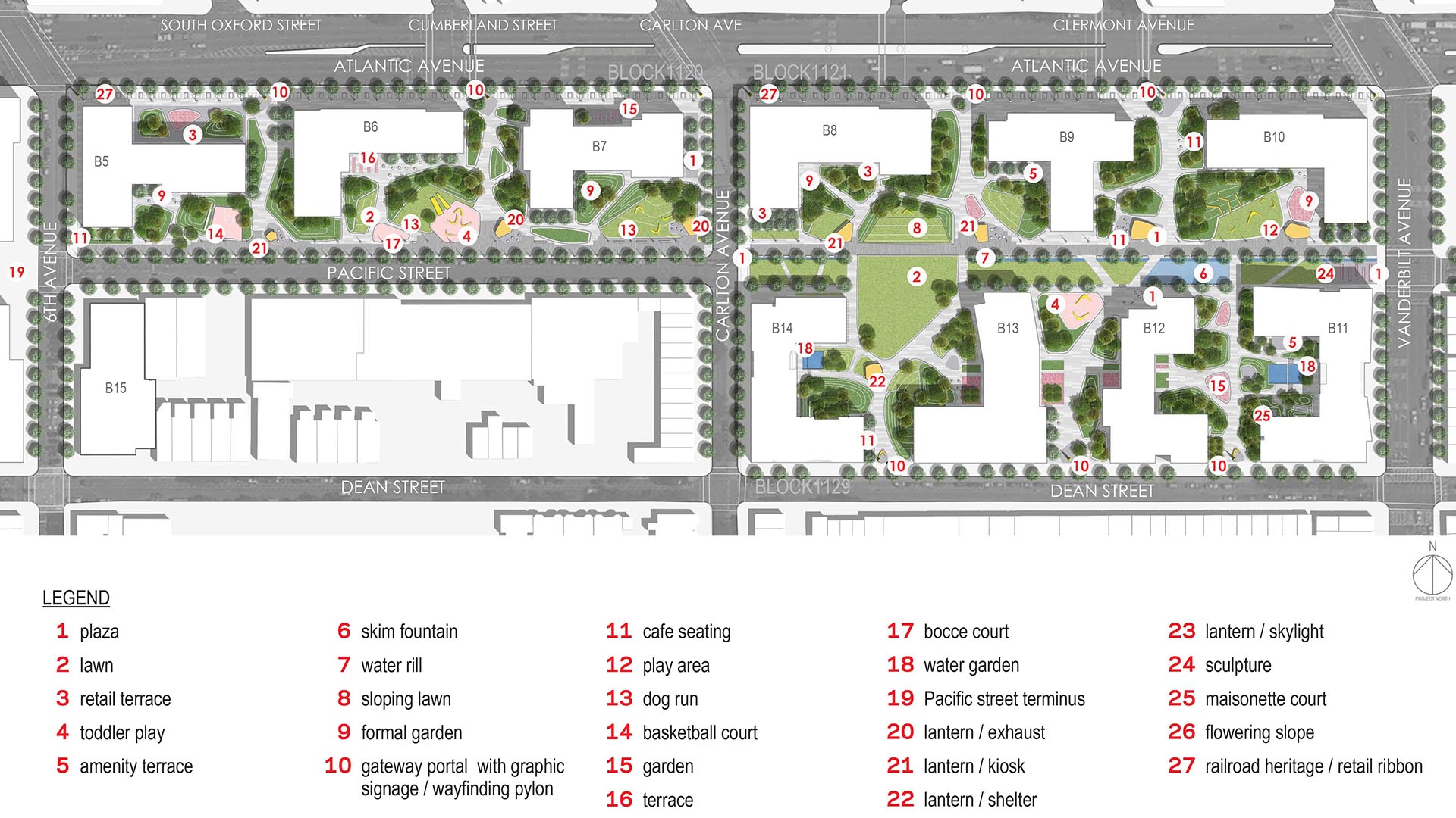
The open space, with an area of about eight acres at grade, is being designed by Thomas Balsley Associates and will be bounded by the residential buildings along the perimeter. Much of the open space will be on top of a “platform” that will cover the rail yard below or on top of below-grade spaces of the buildings.
The landscape will be a cohesive, continuous, and inviting open space with a range of uses and activities, with links from north to south connecting the new development and the surrounding neighborhoods by continuing the existing street system as pedestrian corridors into the open space. The open space will be sheltered from Atlantic Avenue traffic while promoting public access and use. The landscape design will take into account the costs of both construction and future maintenance, a phased implementation strategy with temporary conditions, and a vision for the Pacific Street Terminus – the plaza between buildings B3 and B4.
Gateway Mall Master Plan
The Gateway Mall runs 18 blocks through the center of downtown St. Louis, terminating at the famous Eero Saarinen Arch, and provides a green spine in which the downtown’s workers, residents, and visitors can relax and celebrate urban living.
The mall never fully lived up to the potential envisioned by the civic leaders at the time of its inception. Thom...
South Waterfront Greenway
The new urban plan for South Waterfront includes a 1-1/2 mile extension of downtown’s waterfront parks and the reclamation of the Willamette River for public recreation. The design team worked closely with the City of Portland, developers, and natural resource advocates to strike a balance between development, recreation and re-naturalization of this neglected...
Flushing Commons
This ten-acre mixed-use development with parks, plazas, and retail will become the center of social and retail activity in downtown Flushing. Driven mostly by an influx of immigrants from East Asia, Flushing is one of the fastest-growing and most diverse neighborhoods in the US. Abuzz with shopping and socializing at all hours of the day and evening, its stree...
Dubai Hills Boulevard and Public Realm
Envisioned as a “Garden Oasis” strategically situated where city meets desert, Dubai Hills is a vibrant yet elegant mixed-use community for 21st-century living. The key public realm element of this massive 1,000-hectare development is a 5.6-kilometer urban boulevard lined with shops, residences, and offices – the district’s central spine. For Phase 1, SWA/Bals...


